Route
US 15/501 South, US 1 South, US 15/501 South, US 15/401 South, SC 381 West, NC 381 West, NC 79, NC 381 West, US 74 Business West, NC 38 South, Local Roads, US 1 N to NC 177
US 1 South, US 220 North, US 220 Alt North, NC 705, US 220 Alt North, NC 159 North, Local Roads, NC 42 East, NC 22 North, NC 62 East, US 421 North, I 40 East, I 840 North, US 70 East, I 40 East
Notes
Construction continues at a snail's pace on US 15/501 from Chapel Hill to Pittsboro and the US 1 Vass Bypass.
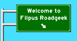
Crossed the South Carolina border on US 15, NC 75 and US 1. On each there are several dead Video Poker parlors. They look pathetic.
Lots of construction south of Candor on the US 220/I 73/I 74 extension to Rockingham. Nice view of bridge construction west of US 220.
The only exit on Future I 840 is numbered 19, which should count around the future loop from the other end at current I 40.
Results
Clinched US 1, US 15, NC 381, NC 38, NC 705, NC 159, NC 22. Almost clinched US 220, need the northern end.
Photographed NC 79 Southern Terminus and NC 177 Northern Terminus
Wednesday, October 27, 2004
Saturday, October 23, 2004
College Visit to JHU
Route
US 15/501 North, I 85 North, I 95 North, I 295 (Md/DC) North, DC 295 North, Baltimore-Washington Parkway North, MD 295, Local Roads to JHU
Local Roads, I 83 South, Local Roads, I 395 South, I 95 South, VA 7100 South, US 1 South to Stafford, I 95 South, I 85 South, US 15/501 South to Chapel Hill
Notes
Going north, no delays at Springfield or the Woodrow Wilson Bridge. Night construction is going on the Virginia approach to the bridge.
The Balitmore-Washington Parkway is a strange duck. It is signed like the Blue Ridge Parkway or the Jamestown/Yorktown Parkway , but appears just to be a highway connecting government complexes and the cities.
Going south, significant delays at the Woodrow Wilson Bridge from both directions. However, once you hit the bridge, traffic went to highway speed.
The BGS north of Richmond illustrating that I-295 goes around Richmond has got to be the stupidest BGS in the southeast.
Results
Clinch I 95, I 295, DC 295, I 495 in DC
Clinch I 295, Baltimore-Washington Parkway, MD 295, I 395 in MD
5 counties in MD, total now 858
Sunday, October 10, 2004
Shenandoah National Park
Route
NC 86 North, I 29 North, VA 6 West, VA 151 North, US 250 West to the Skyline Drive
Notes
There is construction of the Sweetbrier interchange at the south end of Amherst bypass, US 29 reduced to both directions on one carriageway. This is the north end of the US 29 bypass of Lynchburg from the existing US 460 freeway.
US 29 has two names, "Seminole Trail", which hearkens back to when roads were named, and "The 29th Infantry Division Memorial Highway".
There is a very tall water spout on the James River west of the US 29 bridge. The US-29 freeway through Lynchburg is awful. Someday I am going to figure out how to get through Lynchburg without hitting the section of US 29 in front of Walmart. Supposedly, taking US 460 to US 501 is better.
A new entrance to the National Park is being built a little south of the current one. The road, curbing and foundation is in. There is parking in both driections, making getting backcountry permits a little easier, if they move the backcountry permit box to the new entry way.
On some bridge north of Lynchburg, I saw little signs "Lift Blade at Joint". It took a little thinking to realize that these were for snowplows to lift their blades over the bridge joints.
Virginia's secondary roads (round signs) appear to number up into the 1000's. I did see one in the 9000's and one which was numbered "F287", which I assume is a farm road.
Shenandoah National Park is beautiful in October. On our way out, there was a line of cars at the entranceway.
There is a small green "Future I 785 Corridor" sign on US 29 S/US 58 W just west of the interchange with US 58 E. This indicates that I 785 will extend around Danville, at least to US 58 W. Continuing around on the US 29 Bypass would make sense.
Results
Picked up mileage on VA 6, VA 151 and US 250.
Friday, October 08, 2004
Clinch NC 96
Route
I 40 East, US 70 East, US 70 Bus East, NC 96 South, NC 55 East, I 40 West, I 95 North, US 70 Bus West, NC 96 North, US 158 West, I 85 South to Durham NC
Notes
Due to misreading a map, I started out heading for Smithfield to explore the various US 70's there and then head north on NC 96, which I thought ended at US 301 in Selma. When I got to the intersection of US 70 Bus and US 301, I was surprised to see the NC-96 was multiplexed with US 301. Looking at the map, NC 96 continued to NC 55. Oops. I should have taken I 40 to NC 55 in the first place. The US 70's will have to wait.
NC 96 runs through a lot of cotton fields from NC 55 to Zebulon.
Results
Clinched NC 96.
Extended the central section of US 158 around Oxford. I need to connect US 158 from I 85 to the exit north of Henderson to have US 158 continuous from Merchant Millpond to Reidsville.
Subscribe to:
Posts (Atom)